Overview
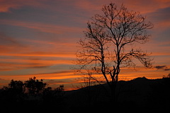
Formerly known as Na Haew National Park, the name was changed to Phu Suan Sai National Park in 2007. The park comprises 117 square kilometres of rugged, mountainous terrain with elevations from about 600 metres to the summit of Phu Khum Khao at 1,350 metres. The habitat is largely forest, with evergreen forest and large areas of bamboo. A number of villages lie within the park and areas around them have been cleared for agriculture. Phu Suan Sai is well off the well trodden birding circuit as it requires time to visit and facilities are somewhat limited. However, it holds several species with very restricted ranges in Thailand - Short-tailed Parrotbill, Indochinese Yuhina, Rufous-throated Fulvetta and Blue-naped Pitta - though none is common and finding them can be very time-consuming. In common with many mountain areas of northern Thailand this park can be surprisingly cold in the winter. Information on this page verified/accurate as of 1 Mar 20189.
|
|
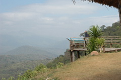
AccessDriving to Phu Suan Sai takes a while as all the access roads are single carriageway through mountains. From the west, from either Uttaradit or Chiang Mai, head for Nam Pat east of Uttaradit, and then follow highways 1239, 1335 and 1268 toward Na Haew. The western park entrance is on the left 20 kilometres before Na Haew. From the southwest, from Phitsanulok, take highway 12 east and then highway 2013 north to Nakhon Thai and Dan Sai, followed by highway 2113 to Na Haew. At Na Haew head west toward Nam Pat and the eastern park entrance will be on the right after about nine kilometres. Accommodation and FacilitiesThe park has a few cabins and bungalows, as well as a camp site, that in theory has hot showers. Note though that water can be in short supply in this area outside the wet season, so showers are occasionally not available. The park HQ has a small restaurant open until 16:00. Outside the park a few kilometres from Na Haew are a couple of small, basic resorts. |
As neither of these resorts offers food, and in Na Haew village it's difficult to impossible to find food stalls open after dark, consider bringing cooking equipment. Three kilometres west of the western park entrance is the government forestry preservation centre at Ban Na Po, which has a sign outside “Tourist Service Centre”. Asking here it is sometimes possible to rent one of the cabins that have warm showers and basic bedding. These cabins are not official accommodation and seem to be available to the public if not required during official visits. Prices are open to negotiation. Food can be arranged with the staff. Foodstuff in general in the Na Haew area is rather limited with only a couple of small mini-marts selling essentials, water, drinks, noodles and the such-like.
Birding
Birdwatching Trail
On the left, just after the HQ and camp site, is the start of the, well signposted, Birdwatching Trail. The trail is well maintained and has signs for Rufous-throated Fulevtta and other species along it. It passes through dense understorey, bamboo, open forest and evergreen forest, before emerging back onto the road about 1.5 km north of the HQ. Several steep sections along the trail can be slippery, and leeches are prevelant in the wet season. Returning along the road makes a good birding circuit for a couple of hours. All of the parks four specialities occur along this loop, though finding them can take days.
Roadside Birding
The paved highway 1236 road runs through the park and provides the majority of the access to forested areas. This road does a loop off the highway and runs for about 20 kilometres. The best areas appear to be the one kilometre stretch after the western entrance/checkpoint, and the four kilometre stretch from the park campsite going north. Simply driving, stopping and walking along this road will access a large variety of habitats and build a solid bird species list over time. Large bamboo stands are found along the road that hold Bamboo Woodpecker, and Pin-tailed Parrotfinch seasonally.
Mountain Trails
According to sign boards at the park HQ there is an extensive network of long trails within the loop road. It is certainly possible to find the start of a couple of these behind the camping area to the left of the restaurant. These trails are very steep and not for the faint hearted, and a GPS should be taken. The trails starting from the HQ area are mostly through bamboo. Other trails entering from the road cannot be readily found as currently are not sign-posted.
Outside the Park
Highway 1268 in both directions offers roadside birding and a number of tracks into scrub and forest which are likely to produce some interesting species, especially in winter. The scrub around the forest centre at Ban Na Po supposedly has Short-tailed Parrotbill according to staff there.
Checklist
Checklist of species.
Sunrise and Sunset
Detailed sunrise and sunset times.