Overview
|
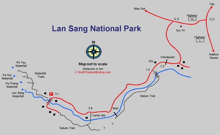
Lan Sang National Park is located south of Tak, just off the main north-south Highway 1, and is passed en route to either Thaksin Maharat National Park or Umphang Wildlife Sanctuary. The altitude ranges from around 250 - 300 metres, around the park entrance, to 1,065 metres at the summit of Doi Oomyod. At lower altitudes, the habitat is a mixture of dry evergreen and Dipterocarp forests, turning to hill evergreen at the highest elevations. The park has an area of 104 square kilometres and is one of the older Thai parks, being established in 1978. Additionally, it has historical significance due to being a site used as a resting point for King Thaksin the Great. Like many smaller parks, it has received next to no attention from birders, but from even a cursory visit in July both Blue-winged Pitta and Small Minivet were found, so should clearly hold other species of interest. Information on this page verified/accurate as of 18 Mar 2023. AccessAccess is straightforward. Follow Highway 1 south of Tak for about six kilometres, and turn right onto Highway 12 toward Mae Sot. Zero the trip meter at this junction. After 12.2 kilometers the park entrance is found on the left hand side. Follow the entrance road for 1.3 kilometres to the checkpoint and a farther 1.8 kilometres to a parking area where the road terminates. |
Accommodation and Facilities
The park has a few bungalows for rent as well as a campsite. A few kiosks and a small restaurant are available near the parking area, but cannot be relied upon to be open. A range of accommodation, restaurants and supermarkets is available in the sizeable town of Tak.
Birding
This area is not well studied. Initially, exploration is best undertaken by walking a loop from the parking area along the road and returning along the nature trail. With more time, several trails can be followed into the hills toward waterfalls.
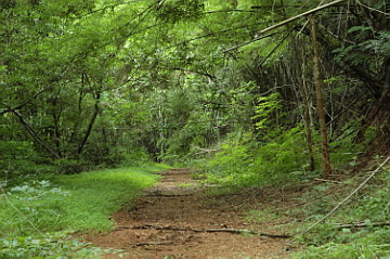
Entrance Road
It's worth birding the whole 3.1 kilometre stretch of the entrance road, as forest starts immediately after turning off the main highway, with Blue-winged Pitta common. Other species encountered will be the usual mixture of lowland barbets, bulbuls and babblers. In the dry season flycatchers and warblers should be expected.
|
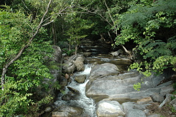
Nature Trail According to maps in the park, it should be possible to walk the Nature Trail all the way from the HQ area to the end of the paved road. However it appears to peter out in the middle. Starting from the HQ, eastern, end the trail starts at a footbridge, ascends the hill slightly and passes through mainly bamboo and dry forest. After about 700 metres it arrives at the river bank, where it seems the easiest way to continue is to cross the weir back onto the main road. Beware though that this concrete weir has a couple of metre wide channels which require striding over, and any slip would result in very wet optics and equipment. Having rejoined the road, continue to the camp site, walk through it to a ford at the back, where it's possible to pick up the western section of the Nature Trail again. |
|
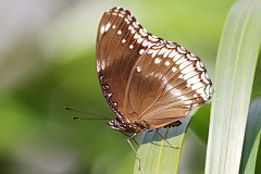
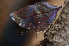
The trail here is wide, open and easy to bird and follows the river closely. Even in the wet season the water in the river here is clear and clean. The habitat looks superb for Blue-eared Kingfisher and Black-backed Forktail which must surely occur. Blue-winged Pitta can also be heard. The whole area appears good for butterflies.
Waterfall Trails
A series of trials starts at the bridge and offers walks of several distances to waterfalls - the farthest being Pa Tay Waterfall after 2.2 kilometres. These trails should pass through both open areas and forest.
Checklist
Checklist of species.
Gallery
Additional images from Lan Sang available in the Thailand Travel gallery.
Sunrise and Sunset
Detailed sunrise and sunset times.